Designing human-centered tools for environmental insight
Satellite Applications Catapult, Map Impact
Map Impact is positioning itself to become the leading provider of biodiversity and climate risk monitoring solutions. By leveraging Earth Observation (EO) data as their primary information source, Map Impact delivers monitoring capabilities across both land and water environments at multiple scales, providing objective evidence of biodiversity status. Their innovative approach combines satellite imagery with ground-sourced data, processed through proprietary analytics and patent-filed machine learning methods to generate nationwide datasets that are complete, consistent, and comparable. In today's regulatory landscape, environmental protection and improvement have evolved from voluntary initiatives to legal mandates. However, conventional ground-based assessment methodologies remain prohibitively expensive and labour-intensive. The UK currently experiences a significant shortage of qualified ecologists needed to perform large-scale environmental evaluations. Map Impact directly addresses this market gap to deliver remote, standardised, and objective baseline assessments that dramatically reduce the time, resources, and costs associated with meeting environmental compliance obligations.
The Design to Deliver programme, funded by Innovate UK, represents a strategic collaboration between three national innovation centers: Connected Places Catapult, Digital Catapult, and Satellite Applications Catapult. This initiative was established to accelerate nature regeneration innovation by supporting 12 small to medium-sized enterprises (SMEs) in developing and deploying solutions with demonstrable environmental impact.
Within this framework, the Satellite Applications Catapult led a specialised challenge focused on leveraging space-enabled data for nature restoration. Four selected SMEs, including Map Impact, received the opportunity to validate their solutions in a real-world environment at Sussex Bay, a designated coastal innovation zone serving as the location partner for this challenge track. Each participating company benefited from comprehensive support, including specialised design expertise and technical guidance tailored to their specific innovation needs.
Mima’s strategic partnership with Map Impact through this program enabled us to apply our expertise in transforming complex technical information into intuitive, human-centered products. Together, we worked to elevate Map Impact's sophisticated satellite-based datasets beyond raw data sets, creating accessible and actionable tools that make environmental monitoring and assessment more efficient and impactful for diverse stakeholders.
The Challenge
Mima guided Map Impact's strategic transition from data provider to product innovator through structured discovery workshops that united key stakeholders to identify shared challenges and value propositions. This initial phase included comprehensive desk research, competitor analysis, and UI/UX inspiration gathering to contextualise Map Impact's offerings.
Our stakeholder mapping exercises helped the team organise their thinking around diverse user segments and highlight common needs, informing Map Impact's market positioning strategy. Interviews with South Downs National Park Authority (SDNPA) Geographic Information System (GIS) experts and nature-based solutions officers revealed specific needs around biodiversity monitoring and governance requirements. We expanded our primary research to include Sussex Bay councils, establishing a broader context for the solution whilst developing initial use cases. By curating User Interface/ User Experience (UX/UI) inspiration from leading mapping technologies and conducting collaborative competitor analysis, we strengthened Map Impact's capacity to critically evaluate their product direction and articulate their unique value proposition with greater clarity.
Throughout the project, we maintained commitment to user-centred design principles and continuous stakeholder engagement, resulting in a solution addressing real challenges within natural capital monitoring.
The Solution
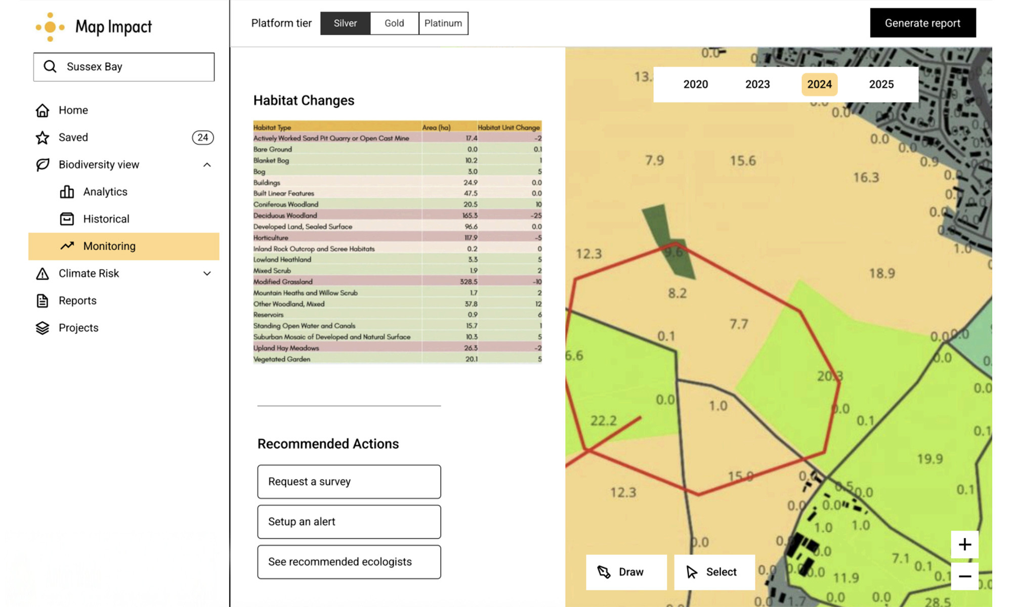
We developed a comprehensive monitoring proof of concept solution enabling landowners, Local Authorities, and stakeholders to track progress toward Biodiversity Net Gain (BNG) targets throughout the mandated 30-year monitoring period. Our approach connected user insights to tangible product outcomes, beginning with co-designed dashboard wireframes that effectively engaged stakeholders.
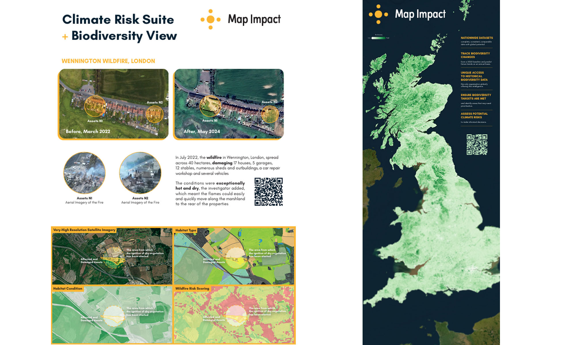
We identified prototyping opportunities leading to minimum viable product (MVP) feature exploration and prioritisation. Multiple dashboard prototype iterations were tested with SDNPA and environmental officers from within the Sussex Bay area. The solution includes Map Impact’s climate risk suite to predict increased occurrences of wildfire, drought, and heat stress, with targeted mitigation recommendations. We systematically tested various product interactions, examining visualisation techniques, reporting granularity, and accessibility considerations.
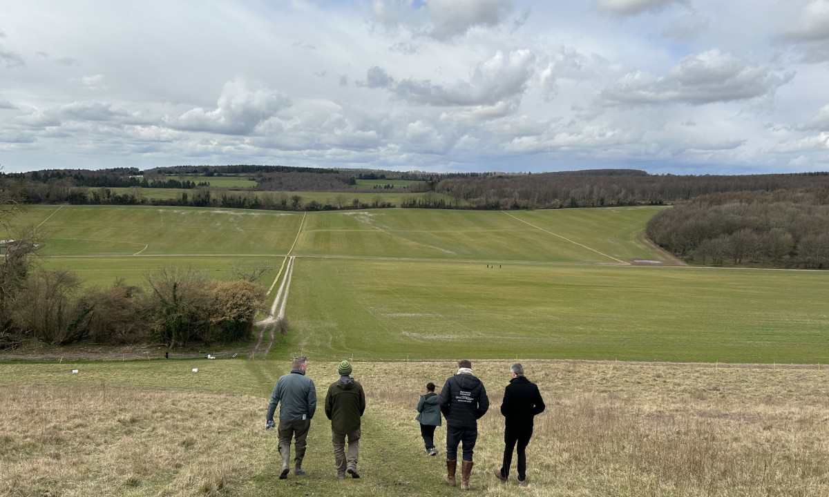
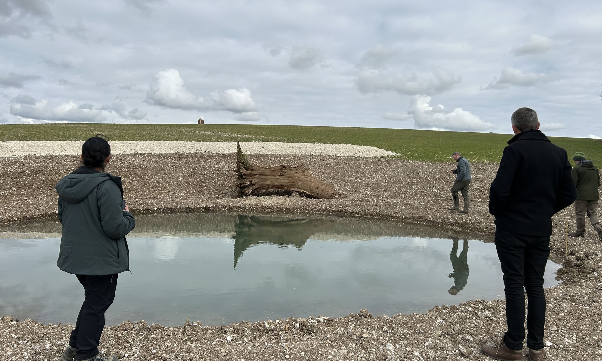
A transformative in-person ideation workshop shifted the team's mindset from "what data do we possess?" to "which user problems can we address?", effectively bridging conceptual understanding and practical solution design. On-site testing at Halnaker Hill Farm yielded invaluable feedback from both the land manager and SDNPA representatives, grounding our theoretical work in real-world application.
Our Impact
Our collaboration with Map Impact supported meaningful progress in aligning their product development with user needs. Together, we clarified which features most effectively addressed user expectations and built confidence to engage stakeholders in early, exploratory conversations.
Previously oriented around data delivery, the team broadened their focus to better understand user priorities. Through structured workshops and collaborative exercises, Map Impact was able to organise strategic thinking, uncover shared priorities across stakeholder groups, and define areas where their product could offer the greatest value. The engagement provided hands-on experience with user-centred design tools and methods, helping to validate product direction through evidence-based insights. By the project’s end, the team had shaped two distinct product pathways, tested early prototypes with positive user feedback, and established relationships with partners who can support continued validation and development.